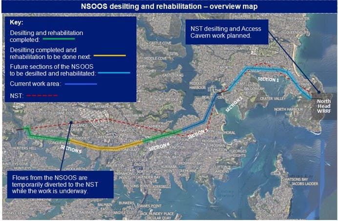
Skip To

  • Skip to content
  • Jump to navigation
  • Search
Globe

IE10 and below are not supported.

Google Chrome Mozilla Firefox

Contact us for any help on browser support

You are here:

  • Home
  • Capital projects
  • Northern Suburbs Ocean Outfall Sewer (NSOOS)

Maps and Photos

Map of the NSOOS from Northwood to Crows Nest
previous next
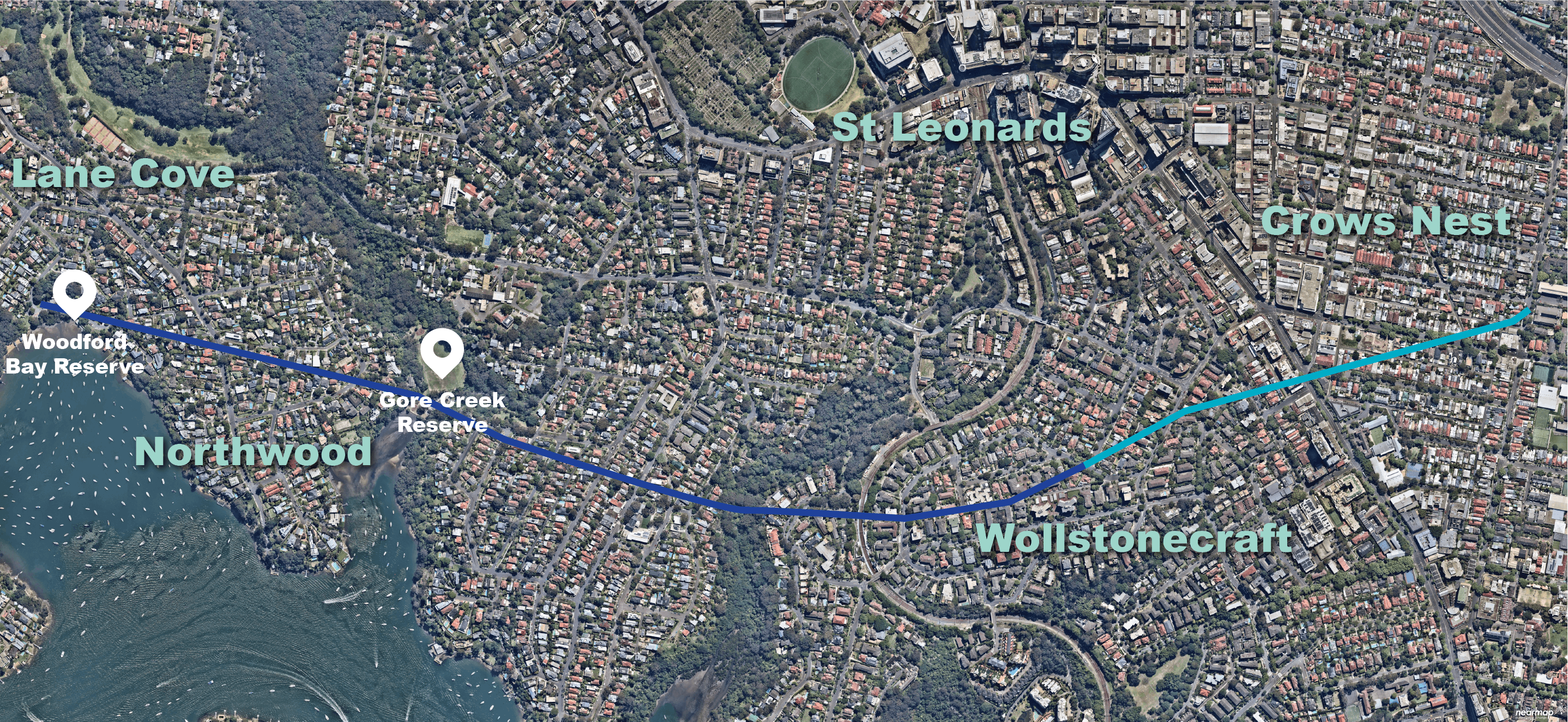
The NSOOS from Woodford Bay, Northwood to West Street, Crows Nest. The light blue line shows the section where works have been completed. The dark blue line represents the section that has been removed of silt and debris with future rehabilitation still to occur.
NSOOS Desilting and Rehabilitation Overview Map.jpg
Map of the NSOOS from Northwood to Crows Nest
Burns Bay Reserve Compound and Surrounds Aerial Photo.jpg
Burns Bay Reserve Restored Area.jpg
Gore Creek Reserve Restoration.jpg
Warraroon Reserve Restoration (Creek).jpg
Warraroon Reserve Restoration.jpg